
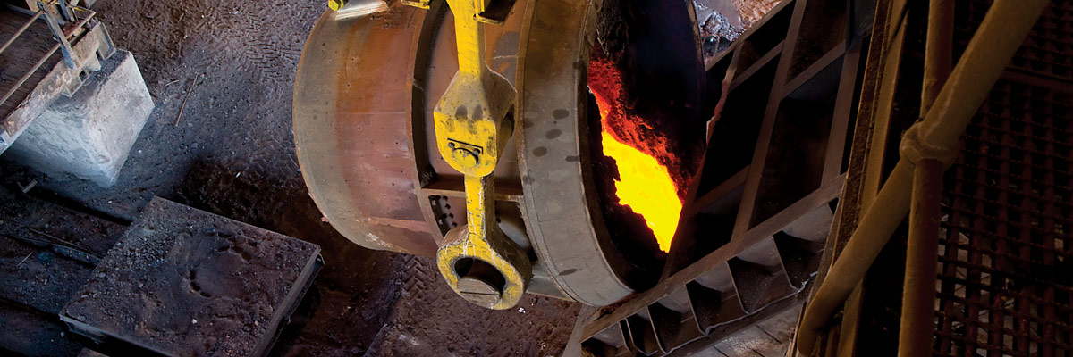
Mineral reserve and resource statement
Resources and reserves reflected in this statement are reported on a Northam attributable basis, and include those which are either from properties that are wholly owned by Northam or its wholly owned subsidiaries, or joint venture properties in which Northam holds a stake.
Mineral resources are reported inclusive of mineral reserves.
SCOPE OF REPORTING
Resources and reserves reflected in this statement include those from the following properties:
- Zondereinde, the company’s wholly owned PGM mine, located in the Thabazimbi area of the Limpopo province and within the northern portion of the western limb of the Bushveld Complex. This includes both the Zondereinde and Middeldrift portions of the property;
- Booysendal, 100% owned by Northam’s wholly owned subsidiary, Micawber 278 Proprietary Limited (Micawber) and situated in the southern portion of the eastern limb of the Bushveld Complex;
- Dwaalkop, located in the northern portion of the eastern limb of the Bushveld Complex, in which Northam holds a 50% stake through its wholly owned subsidiary Mvelaphanda Resources. Dwaalkop is managed by Lonmin plc (Lonmin); and
- Pandora, located in the Brits area of North West province and within the southern portion of the western limb of the Bushveld Complex, in which Northam holds a 7.5% stake. Pandora is managed by Lonmin.
KEY POINTS AND SIGNIFICANT REVISIONS FROM LAST YEAR
- An increase in the measured UG2 reef resource at Booysendal UG2 North mine, owing to a reduction in geological losses informed by ongoing mine mapping, sampling and exploration drilling programmes.
- A material increase in the total UG2 reef reserve at Booysendal UG2 North mine, following the implementation of an amended mining layout, resulting in reduced mining pillar losses and a greater extraction rate.
REGULATORY COMPLIANCE
The mineral resource and mineral reserve statements for Northam have been prepared under the guidance of the company’s lead competent persons who are duly registered with the South African Council for Professional and Technical Surveyors (PLATO) and/or with the South African Council for Natural Scientific Professions (SACNASP). This ensures that the mineral resource and mineral reserve statements comply with the provisions of the South African Code for Reporting of Mineral Resources and Mineral Reserves of 2007, revised in 2009 (SAMREC 2009). The company’s competent persons have taken cognisance of definitions included in the code. The mineral resource and mineral reserve quantities reported here are considered to be fully compliant in all material respects with the requirements of the code, and the lead competent persons have given written confirmation of such.
STATUS OF MINERAL RIGHTS
Resources reflected in this statement include those of the Zondereinde and Booysendal concessions which are wholly owned by Northam or its wholly owned subsidiaries. In addition, Northam holds a 7.5% stake in the Pandora joint venture and a 50% stake in the Dwaalkop joint venture, both of which are managed by Lonmin, through its subsidiaries, Eastern Platinum Limited and Western Platinum Limited respectively.
Northam holds new order mining rights over both the Zondereinde and Booysendal mines.
The Pandora mine operates under a new order mining right which was converted from an old order right in 2013.
The Dwaalkop joint venture holds a new order prospecting right over the Dwaalkop prospect. This right is subject to a renewal application. An application for a new order mining right was submitted in 2009 and is being processed.
Northam further holds eight new order prospecting rights over the Kokerboom prospect, granted in 2009. Kokerboom is an iron oxide copper gold and massive sulphide copper zinc exploration prospect covering some 1 000 000 hectares of the Northern Cape province of the Republic of South Africa. A prospecting work programme is currently in progress and no resource or reserve has yet been estimated.
CONTINUING OPERATIONS
The company confirms that it is not aware of any legal or arbitration proceedings, either pending or threatened, which may have or have had a material effect on the financial position of the company and its subsidiaries.
Further to this, the risk management section analyses potential risks which may impact the company’s ability to continue its activities.
ENVIRONMENTAL LIABILITIES
The company’s environmental obligations are managed in terms of approved environmental management plans. Compliance with the plans is audited by independent external parties on a regular basis. Details of the environmental liabilities are contained in note 20 to the 2014 annual financial statements and details of the funding of the environmental liabilities are contained in notes 10 and note 11 to the 2014 annual financial statements.
COMPETENT PERSONS
The resource and reserve statement for the Zondereinde and Middeldrift portions of Zondereinde mine were compiled by Charl van Jaarsveld, BSc (Hons) Geology, PrSciNat. (400268/05), chief geologist at the Zondereinde mine with 11 years’ experience relevant to Bushveld-related resource and reserve estimation.
The Booysendal resource statement was compiled by Meshack Mqadi, BSc (Hons) Geology, MGSSA (966985), chief geologist at Booysendal UG2 North mine with six years’ experience relevant to precious metal-related resource estimation.
The Booysendal reserve statement was compiled by Willie Theron, BSc (Hons) Mining, PrCertEng, ECSA (200790030), general manager at Booysendal UG2 North mine with 17 years’ experience of Bushveld-related underground mining and reserve estimation.
Resource and reserve estimates for both Zondereinde and Booysendal were reviewed by Damian Smith, BSc (Hons) Geology, MSc, PrSciNat. (400323/04), principal member of Prospect Geoservices with 24 years’ experience in mining and exploration geology, 18 years of which are relevant to Bushveld-related resource and reserve estimation.
The resource and reserve estimates for the Pandora joint venture were prepared by a team from both Anglo Platinum and Lonmin. Resources were signed off by J Whitley (Lonmin) and P. Stevenson (Anglo Platinum), while reserves were signed off by AA Brown (Lonmin).
The resource and reserve estimates for the Dwaalkop joint venture were prepared by a team from Snowden Mining Industry Consultants (Resources) and from AMC Consulting (Pty) Limited (Reserves). Resources were signed off by D Hoffmann (Lonmin), while reserves were signed off by AA Brown (Lonmin).
Contact details for Northam’s lead competent persons authorising publication of the resource estimates are contained within the notes on reporting criteria within this report.
GEOLOGICAL SETTING – THE BUSHVELD COMPLEX
The two-billion-year-old Bushveld Complex is the largest layered igneous complex in the world, and is the repository for around 85% of known global PGM resources. Extending over an area of some 67 000km2 within the north-eastern portion of the Republic of South Africa, it contains the intrusive, mafic-ultramafic Rustenburg Layered Suite (RLS), which outcrops as three main acicular limbs, namely the western, eastern and northern limbs (see figure below), and ranges in thickness from 7km to 12km.
The magmatic layering in the RLS is laterally persistent and can be correlated throughout most of the complex. Layering is generally shallow dipping towards the centre of the complex. The RLS stratigraphy is sub-divided into five zones, which are, from lowest to highest, the marginal zone, the lower zone, the critical zone (which is further subdivided into a lower and upper unit), the main zone and the upper zone.
PGM and associated precious and base metal mineralisation is hosted in or adjacent to chromitite seams located within the upper critical zone of the RLS. There are two significant ore bodies from which 75% of global primary PGM production is derived, these being the UG2 and Merensky reefs. The vertical separation between the UG2 and Merensky reefs is variable across the Bushveld Complex, ranging from 20m to 140m on the western limb and between 170m and 400m on the eastern limb.
Historically, PGM production was concentrated on the western limb but, in recent years, the eastern limb has been the focus of new mine development.
The two wholly-owned Northam properties, the Zondereinde and Booysendal mines, contain resources of both the UG2 and Merensky reefs.
Bushveld location indicating current PGM mining operations
![Bushveld location indicating current PGM mining operations [Operations map]](https://northam.co.za/assets/investors/reports/2014/images/bushveld-location.png)
NOTES ON REPORTING CRITERIA
- Mineral resource tonnages and grades for Zondereinde are reported as estimates discounted for geological and mining pillar losses. All other mineral resources are reported as estimates discounted for geological losses.
- Mineral resource tonnages and grades are in situ estimates inclusive of internal waste dilution but exclusive of external waste dilution.
- PGM grade is expressed as corrected 4E (combined platinum, palladium, rhodium and gold) grade; this being synonymous with 3PGE+Au.
- PGM metal prill splits (platinum, palladium, rhodium and gold) are expressed as percentages of the combined 4E value.
- Base metal contents (chromite, copper and nickel) are expressed as weight percentages.
- Structural losses, due to faults, dykes and joints, include the volumes of expected bracket pillars required to be placed on such features.
- Kriging parameters are applied to discrete mining areas in order to estimate tonnage and metal content.
- Kriging parameters are derived from the interrogation of extensive sampling databases.
- Rounding of numbers in the tables may result in minor computational discrepancies. Where this occurs, it is deemed insignificant.
- The most reasonable mining width is assumed, based on practical mining conditions. 4E grade, as well as specific gravity are calculated for these widths.
- Total mineral resources and reserves attributable to Northam Platinum Limited are listed in the summary tables.
- Mineral resources for Pandora and Dwaalkop, reflecting Northam is 7.5% and 50.0% respective attributable interests, are quoted as at the end of September 2013 and 2012 and are provided by Lonmin.
- Measured and indicated mineral resources are reported separately and include those mineral resources modified to produce proven and probable mineral reserves.
- While mineral resources are quoted as in-situ resources, all reserves provided by Northam are quoted at run-of-mine (ROM) grades and tonnages as delivered to the concentrator plants on site and are therefore, fully diluted.
- Mineral reserves for Zondereinde mine are quoted to 16 level (2 228m below surface).
- Mineral reserves for Booysendal relate to the first planned mining module, the UG2 North mine.
- Mineral reserves for Pandora and Dwaalkop are provided by Lonmin and reflect Lonmin’s reserve modifying factors.
- All references to tonnage are to the metric unit.
- All references to ounces are troy with a conversion factor of 31.103475 used to convert from metric grams to ounces.
Contact details for lead competent persons are:
- Mr C van Jaarsveld, chief geologist at Zondereinde mine
PO Box 441, Thabazimbi 0380 - Mr M Mqadi, chief geologist at Booysendal UG2 North mine
- Mr W Theron, general manager at Booysendal UG2 North mine
PO Box 412694, Craighall 2024 - Mr D Smith, principal member of Prospect Geoservices
PO Box 37876, Faerie Glen 0043
GROUP RESOURCES AND RESERVES
The following tables summarise the mineral resources and reserves attributable to Northam for both the current and previous year. Notes on the reporting criteria are pertinent, together with specific notes to this section.
Breakdowns of the mineral resources and reserves into their respective confidence categories may be found in the sections specific to the concessions.
| Property | Type of right | Status |
|---|---|---|
| Zondereinde mine | New order mining right | Converted mining right |
| Booysendal mine | New order mining right | Converted mining right |
| Pandora mine | New order mining right | Converted mining right |
| Dwaalkop prospect | New order prospecting right | Application for a new order mining right in process |
| Kokerboom prospect | New order prospecting right | Eight new order prospecting rights granted |
Prospecting and mining rights are held in good order, and Northam perceives no risk to its rights to continue prospecting for and mining of minerals over any of its properties.
| as at 30 June 2014 | as at 30 June 2013 | ||||||
|---|---|---|---|---|---|---|---|
| 4E PGE | 4E PGE | ||||||
| Reef | Mine | Mt | g/t | Moz | Mt | g/t | Moz |
| Merensky | Booysendal North | 164.90 | 5.32 | 28.22 | 164.90 | 5.32 | 28.22 |
| Booysendal South | 90.57 | 3.54 | 10.32 | 90.57 | 3.54 | 10.32 | |
| Booysendal UG2 mine | 0.00 | 0.00 | 0.00 | 0.00 | 0.00 | 0.00 | |
| Dwaalkop1 | 38.05 | 2.98 | 3.64 | 38.05 | 2.98 | 3.64 | |
| Pandora1 | 0.00 | 0.00 | 0.00 | 0.00 | 0.00 | 0.00 | |
| Zondereinde | 168.12 | 7.36 | 39.77 | 169.09 | 7.37 | 40.08 | |
| Total | 461.64 | 5.52 | 81.95 | 462.61 | 5.53 | 82.26 | |
| UG2 | Booysendal North | 328.77 | 3.61 | 38.19 | 328.77 | 3.61 | 38.19 |
| Booysendal South | 208.10 | 3.10 | 20.74 | 208.10 | 3.10 | 20.74 | |
| Booysendal UG2 mine | 44.13 | 4.52 | 6.41 | 40.75 | 4.36 | 5.71 | |
| Dwaalkop1 | 37.56 | 4.35 | 5.25 | 37.56 | 4.35 | 5.25 | |
| Pandora1 | 14.18 | 4.65 | 2.12 | 14.25 | 4.65 | 2.13 | |
| Zondereinde | 247.16 | 5.08 | 40.37 | 248.35 | 5.08 | 40.59 | |
| Total | 879.90 | 4.00 | 113.08 | 877.78 | 3.99 | 112.62 | |
| Combined | Booysendal North | 493.67 | 4.18 | 66.41 | 493.67 | 4.18 | 66.41 |
| Booysendal South | 298.67 | 3.23 | 31.06 | 298.67 | 3.23 | 31.06 | |
| Booysendal UG2 mine | 44.13 | 4.52 | 6.41 | 40.75 | 4.36 | 5.71 | |
| Dwaalkop1 | 75.61 | 3.66 | 8.90 | 75.61 | 3.66 | 8.90 | |
| Pandora1 | 14.18 | 4.65 | 2.12 | 14.25 | 4.65 | 2.13 | |
| Zondereinde | 415.29 | 6.00 | 80.14 | 417.45 | 6.01 | 80.67 | |
| Total | 1341.55 | 4.52 | 195.04 | 1 340.38 | 4.52 | 194.88 | |
- 1 Current resources and reserves of Pandora and Dwaalkop are quoted as at 30 September 2013 while those of the previous year re at 30 September 2012.
| as at 30 June 2014 | as at 30 June 2013 | ||||||
|---|---|---|---|---|---|---|---|
| 4E PGE | 4E PGE | ||||||
| Reef | Mine | Mt | g/t | Moz | Mt | g/t | Moz |
| Merensky | Booysendal North | 0.00 | 0.00 | 0.00 | 0.00 | 0.00 | 0.00 |
| Booysendal South | 0.00 | 0.00 | 0.00 | 0.00 | 0.00 | 0.00 | |
| Booysendal UG2 mine | 0.00 | 0.00 | 0.00 | 0.00 | 0.00 | 0.00 | |
| Dwaalkop1 | 13.66 | 2.61 | 1.15 | 13.66 | 2.61 | 1.15 | |
| Pandora1 | 0.00 | 0.00 | 0.00 | 0.00 | 0.00 | 0.00 | |
| Zondereinde | 15.96 | 5.40 | 2.77 | 12.80 | 5.84 | 2.40 | |
| Total | 29.62 | 4.12 | 3.92 | 26.46 | 4.17 | 3.55 | |
| UG2 | Booysendal North | 0.00 | 0.00 | 0.00 | 0.00 | 0.00 | 0.00 |
| Booysendal South | 0.00 | 0.00 | 0.00 | 0.00 | 0.00 | 0.00 | |
| Booysendal UG2 mine | 44.82 | 3.00 | 4.32 | 33.27 | 2.96 | 3.17 | |
| Dwaalkop1 | 16.10 | 3.30 | 1.71 | 16.10 | 3.30 | 1.71 | |
| Pandora1 | 1.31 | 4.11 | 0.17 | 1.36 | 4.02 | 0.18 | |
| Zondereinde | 37.25 | 4.19 | 5.02 | 34.24 | 4.39 | 4.83 | |
| Total | 99.48 | 3.51 | 11.22 | 84.97 | 3.62 | 9.88 | |
| Combined | Booysendal North | 0.00 | 0.00 | 0.00 | 0.00 | 0.00 | 0.00 |
| Booysendal South | 0.00 | 0.00 | 0.00 | 0.00 | 0.00 | 0.00 | |
| Booysendal UG2 mine | 44.82 | 3.00 | 4.32 | 33.27 | 2.96 | 3.17 | |
| Dwaalkop1 | 29.76 | 2.98 | 2.85 | 29.76 | 2.98 | 2.85 | |
| Pandora1 | 1.31 | 4.11 | 0.17 | 1.36 | 4.02 | 0.18 | |
| Zondereinde | 53.20 | 4.55 | 7.79 | 47.04 | 4.78 | 7.23 | |
| Total | 129.09 | 3.65 | 15.13 | 111.42 | 3.75 | 13.43 | |
- 1 Current resources and reserves of Pandora and Dwaalkop are quoted as at 30 September 2013 while those of the previous year are at 30 September 2012.
ZONDEREINDE MINE
Zondereinde location and access routes
![Zondereinde location [map]](https://northam.co.za/assets/investors/reports/2014/images/zondereinde-location.png)
Zondereinde mine is situated in the northern portion of the western limb of the Bushveld Complex, approximately 30km south of the town of Thabazimbi in the Limpopo province of the Republic of South Africa. The mining concession covers some 7 625ha underlain by both the Merensky and UG2 ore bodies, which dip at approximately 20° and extend from a depth of 1 100m below surface to 2 900m below surface.
The company exploits both the Merensky and UG2 reefs of the upper critical zone of the Bushveld Complex. While there is lateral continuity of both reefs across the mine property, the Merensky reef displays a variety of reef types. The distribution of these is determined by a combination of surface exploration boreholes, ongoing prospect drilling from underground development and reef mapping in development and stoping. In contrast to the Merensky reef, the UG2 displays little variation in reef attributes.
The Bushveld sequence at Zondereinde is typical of the northern portion of the western limb. The critical zone stratigraphy is telescoped and dominated by mafic lithologies. Vertical separation between the UG2 and Merensky reefs is in the range of 20m to 40m.
Combined geological and extraction losses were discounted from the resources for both reefs. These comprised pothole and structural losses as well as other pillar losses. Discount losses vary per Merensky reef type and resource category, but average at 33% for Merensky reef and 48% for UG2.
History and mining activities
Development of Zondereinde mine started in 1986, following a five year exploration programme. Mining of ore, commissioning of a PGM concentrator, smelter and base metal removal plant and the sale of first PGMs came in 1993. The mine originally exploited only the Merensky reef resource but the commissioning of a UG2 concentrator in 2000, together with the necessary underground ore handling systems, allowed mining and processing of UG2 from this time onwards. The mine produces approximately 2 000 000 tonnes of ore per annum, generating in the order of 300 000oz of 3PGE+Au in final concentrate together with associated precious and base metal by-products.
Underground mining focuses on the exploitation of PGM ores by means of traditional narrow tabular reef drill and blast mining methods. A standard breast mining layout is used at Northam. The vertical interval (distance) between levels is 63m. With the ore body dipping at 20°, this provides a raise length of 180m allowing for six panels of 30m each per raise connection. Strike gullies are inclined at 10° above the strike direction. A dip gully handles the ore transported via the strike gullies to three orepasses situated in the original raise, all of which are fitted with radial-door control chutes. Ore is transported to the main shaft ore passes by battery powered locomotives (locos) pulling spans of eight hoppers. Broken ore is transported to a conventional shaft ore-pass system with separate rock handling facilities for Merensky reef, UG2 reef and waste.
Mining is successfully conducted using hydropowered equipment such as rock drills and high-pressure water jets in conjunction with electric scraper winches.
The underground workings are accessed from a twin shaft system. No 1 shaft extends to 13 level (2 039m below surface) and No 2 shaft serves workings down to 8 level (1 724m below surface). The shafts are 90m apart and are interconnected at an intermediate pump chamber (IPC) at 1 019m below surface, and also on levels 2, 4, 6, 7, 8 and 9. Workings below 13 level are serviced by a decline access way, designed to accommodate both people and materials, and equipped with a conveyor belt system that transports the broken rock.
Merensky reef
The Merensky reef is a zone of mineralisation which straddles the base of the Merensky cyclic unit. In the area of Zondereinde mine, the Merensky reef consists of two sub-facies of the Zwartklip facies of the RLS, namely the normal and regional pothole sub-facies. The latter may be further subdivided into three reef types, each of which occurs at a specific stratigraphic level below that of the normal reef sub-facies. These being NP2 and P2, which constitute the main sources of ore, and FWP2 which, while not considered a primary mining target due to the undulating nature of this reef type, is successfully exploited in the south-western quadrant of the current mining area where it displays lesser disruption.
The stoping cut on the Merensky reef is dependent upon the reef type mined and the geozone in which it is located. In all stoping cuts, the Merensky chromitite is exposed with a minimum of 10cm of the overlying mineralized Merensky pyroxenite as hanging wall.
The measured resource is an estimate of the in situ tonnage, grade and 4E PGM ounces that have been exposed through development and are immediately available for mining. The Merensky measured resource has increased from 2.79Mt (744 000oz) in June 2013 to 2.91Mt (746 000oz) in June 2014. This is the result of an increase to the exposed Merensky resource, combined with the application of a lower resource grade owing to a higher proportion of moderate grade Normal reef in the deeper portions of the resource block.
The Merensky indicated resource has declined as a result of conversion to the measured category. The Merensky inferred resource is essentially unchanged.
UG2 reef
The UG2 reef at Zondereinde mine is remarkably conformable when compared with the Merensky reef. Disruption, in the form of potholes and reef rolls, is extremely limited and localised. The reef consists of three chromitite seams separated by narrow pyroxenite partings. The lower seam, termed the main member, is generally in the order of 85cm thick, and is overlain by two leader seams, each in the order of 15cm thick. Total reef thickness, inclusive of a portion of mineralised reef footwall, is in the order of 150cm to 160cm. There is no basis for subdividing the UG2 reef into facies types.
Historically, UG2 mining has been limited to de-stressed areas underlying previously mined Merensky reef. Furthermore, a full reef cut is mined, which enhances metal output, hanging wall stability and safe working practices.
The measured resource is an estimate of the in situ tonnage, grade and PGM ounces that have been exposed through development and are immediately available for mining. The UG2 measured resource has decreased from 4.52Mt (730 000oz) in June 2013 to 4.26Mt (689 000oz) in June 2014. This is the result of a decrease in exposed UG2 resource and is in line with mining depletion and planned development of the UG2 reef. The UG2 indicated resource has declined in line with mining depletion. The UG2 inferred resource is essentially unchanged.
ZONDEREINDE RESOURCES AND RESERVES
| as at 30 June 2014 | as at 30 June 2013 | ||||||
|---|---|---|---|---|---|---|---|
| 4E PGE | 4E PGE | ||||||
| Reef | Category | Mt | g/t | Moz | Mt | g/t | Moz |
| Merensky | Measured | 2.91 | 7.98 | 0.75 | 2.79 | 8.29 | 0.74 |
| Indicated | 18.70 | 7.03 | 4.22 | 19.76 | 7.09 | 4.50 | |
| Inferred | 146.52 | 7.39 | 34.80 | 146.54 | 7.39 | 34.83 | |
| Total | 168.13 | 7.36 | 39.77 | 169.09 | 7.37 | 40.08 | |
| UG2 | Measured | 4.26 | 5.03 | 0.69 | 4.52 | 5.04 | 0.73 |
| Indicated | 35.70 | 5.03 | 5.77 | 36.64 | 5.04 | 5.94 | |
| Inferred | 207.20 | 5.09 | 33.91 | 207.20 | 5.09 | 33.92 | |
| Total | 247.16 | 5.08 | 40.37 | 248.35 | 5.08 | 40.59 | |
| Combined | Measured | 7.17 | 6.23 | 1.43 | 7.31 | 6.28 | 1.48 |
| Indicated | 54.40 | 5.71 | 9.99 | 56.40 | 5.76 | 10.44 | |
| Inferred | 353.72 | 6.04 | 68.72 | 353.74 | 6.05 | 68.75 | |
| Total | 415.29 | 6.00 | 80.14 | 417.45 | 6.01 | 80.67 | |
| as at 30 June 2014 | as at 30 June 2013 | ||||||
|---|---|---|---|---|---|---|---|
| 4E PGE | 4E PGE | ||||||
| Reef | Category | Mt | g/t | Moz | Mt | g/t | Moz |
| Merensky | Proven | 3.56 | 5.77 | 0.66 | 3.29 | 6.14 | 0.65 |
| Probable | 12.40 | 5.30 | 2.11 | 9.51 | 5.73 | 1.75 | |
| Total | 15.96 | 5.40 | 2.77 | 12.80 | 5.84 | 2.40 | |
| UG2 | Proven | 4.71 | 4.19 | 0.64 | 4.78 | 4.39 | 0.67 |
| Probable | 32.53 | 4.19 | 4.38 | 29.49 | 4.39 | 4.16 | |
| Total | 37.24 | 4.19 | 5.02 | 34.24 | 4.39 | 4.83 | |
| Combined | Proven | 8.27 | 4.87 | 1.30 | 8.07 | 5.10 | 1.32 |
| Probable | 44.93 | 4.50 | 6.49 | 38.97 | 4.72 | 5.91 | |
| Total | 53.20 | 4.55 | 7.79 | 47.04 | 4.78 | 7.23 | |
| Prill splits % | Pt | Pd | Rh | Au | Cr2O3% | Cu | Ni% |
|---|---|---|---|---|---|---|---|
| UG2 | 57.7 | 30.9 | 10.3 | 1.0 | 27.6 | 0.021 | 0.123 |
| Merensky | 63.0 | 29.2 | 5.2 | 2.6 | 0.8 | 0.072 | 0.164 |
BOOYSENDAL MINE
Booysendal location and access routes
![Booysendal location [map]](https://northam.co.za/assets/investors/reports/2014/images/booysendal-location.png)
The Booysendal concession is located in the southern compartment of the eastern limb of the Bushveld Complex, approximately 35km west of the town of Mashishing (formerly Lydenburg), straddling the border of Limpopo and Mpumalanga provinces in the Republic of South Africa.
The concession covers some 15 151 hectares and hosts both the UG2 and Merensky ore bodies, which outcrop over a strike length of 14.5km and dip at approximately 10° to the west.
The resource estimate is informed by exploration data, including 248 boreholes, together with channel sampling from on-reef development within the UG2 North mine. 90% of the exploration drilling was conducted within 2.5km down-dip of outcrop. Drill hole spacing in this near outcrop area ranges from 150m to 400m. Channel samples are located at 15m intervals within on-reef development and stoping.
A study to determine the feasibility of mining UG2 and Merensky reefs within the northernmost 8km of the Booysendal strike, over a dip extent from outcrop of approximately 2km, was completed in September 2009.
Development of a UG2 mine (UG2 North mine) in the northernmost 4km of strike started in May 2010.
The resource estimate for the Booysendal concession is subdivided into three sections, these being the southern section of Booysendal South; the UG2 North mine; and the remainder of the northern section of the concession (Booysendal North). A mineral reserve estimate is presented for the UG2 North mine only.
The Bushveld sequence at Booysendal is similar to that found across the southern compartment of the eastern limb. The critical zone stratigraphy is fully developed, and middling between the UG2 and Merensky reefs is in the order of 175m in the northern portion of Booysendal. The sequence is, however, subject to thinning in the southern portion, which is linked to the Bushveld rocks abutting basement highs. The impact of this ‘abutment’ is further manifested in localised zones of disruption to surface morphology and internal structure of the two reefs. This has led to the characterisation of three geozones within the Booysendal concession, these being the normal, slump and abutment geozones. Despite this progressive disruption to the south, the continuity of the reef surfaces is robust across the property.
The internal structure of the UG2 reef is similar to that found on the Bushveld western limb, while the Merensky reef is typical of the northern portion of the Bushveld eastern limb.
The UG2 reef consists of an upper leader chromitite and a lower main chromitite with a combined thickness of some 140cm. These seams are generally juxtaposed or merged, but can display variable internal silicate partings.
The Merensky reef is the upper mineralised portion of the Merensky pyroxenite, generally extending over 110cm. The Merensky reef is immediately overlain by a sequence of competent norites.
Resources were estimated over the reef channels. For the UG2 reef, the reef channel extends from the top of the leader chromitite to the base of the main chromitite seam. For the Merensky reef, the reef channel extends from the top of the Merensky pyroxenite to a sample grade cut off of 1g/t, with a minimum mining channel width of 80cm applied.
Geological losses were discounted from the resources for both reefs. These, for the Booysendal North and South sections, comprised known pothole and structural losses, together with assumed pothole losses benchmarked to mean eastern limb losses. They amounted to 23% for the Merensky reef and 24% and 30% for the UG2 in the North and South sections respectively. In the UG2 North mine section, ongoing mining and exploration drilling has improved confidence in known geological losses, leading to the application of 12.5% total geological loss for the UG2 reef. Furthermore, a channel cut-off 4E grade of 2.5g/t was applied to estimated blocks in all three sections. In addition, a 30m thick surface oxidized zone was discounted along the lines of outcrop of both reefs.
Resource categorisation was based upon a combination of quantitative geostatistical parameters, together with a qualitative appreciation of ore body continuity informed by the resource database together with data from surrounding properties.
Mine design and mining activities
The UG2 North mine is an underground, mechanised bord and pillar mine, accessed from surface via a ramp decline system, comprising three declines on the plane of reef and one decline situated 20m into the footwall of the reef, containing a belt for ore handling.
Mining sections extend over a dip length of 144m, equating to a vertical interval of 25m. Strike drives are inclined at 5° above the line of strike, strike belts within the drives will transport ore to the central decline system, tipping through an ore pass system to the footwall belt for transport to a UG2 concentrator plant on surface. Mechanised boom rigs and LHDs are employed in mining and development.
The mine is planned, with a remaining life of 22 years, to produce 2 250 000 tonnes of ore per annum at steady state, generating in the order of 160 000oz of metals in concentrate (3PGE+Au), together with associated precious and base metal by-products. It is in build-up phase and is expected to reach steady state in H1 of F2016.
Booysendal resources and reserves
The UG2 measured resource for the UG2 North mine has increased from 40.75Mt (5.71Moz) in June 2013 to 44.13Mt (6.41Moz) in June 2014, as a result of the decrease in geological losses, partially offset by mining depletion.
Merensky and UG2 resources for Booysendal North and South sections remain unchanged.
Conversion of resources to reserves for the UG2 North mine includes a mining pillar loss discount. An amendment to the mining layout, which was implemented during the reporting period, has led to a 12% decrease in total pillar loss. This, together with a marginal improvement in reserve grade, has resulted in a material increase in total reserves from 33.27Mt (3.17Moz) in June 2013 to 44.82Mt (4.32Moz) in June 2014.
| as at 30 June 2014 | as at 30 June 2013 | ||||||
|---|---|---|---|---|---|---|---|
| 4E PGE | 4E PGE | ||||||
| Reef | Category | Mt | g/t | Moz | Mt | g/t | Moz |
| Merensky | Measured | 0.00 | 0.00 | 0.00 | 0.00 | 0.00 | 0.00 |
| Indicated | 0.00 | 0.00 | 0.00 | 0.00 | 0.00 | 0.00 | |
| Inferred | 0.00 | 0.00 | 0.00 | 0.00 | 0.00 | 0.00 | |
| Total | 0.00 | 0.00 | 0.00 | 0.00 | 0.00 | 0.00 | |
| UG2 | Measured | 44.13 | 4.52 | 6.41 | 40.75 | 4.36 | 5.71 |
| Indicated | 0.00 | 0.00 | 0.00 | 0.00 | 0.00 | 0.00 | |
| Inferred | 0.00 | 0.00 | 0.00 | 0.00 | 0.00 | 0.00 | |
| Total | 44.13 | 4.52 | 6.41 | 40.85 | 4.36 | 5.71 | |
| Combined | Measured | 44.13 | 4.52 | 6.41 | 40.75 | 4.36 | 5.71 |
| Indicated | 0.00 | 0.00 | 0.00 | 0.00 | 0.00 | 0.00 | |
| Inferred | 0.00 | 0.00 | 0.00 | 0.00 | 0.00 | 0.00 | |
| Total | 44.13 | 4.52 | 6.41 | 40.75 | 4.36 | 5.71 | |
| as at 30 June 2014 | as at 30 June 2013 | ||||||
|---|---|---|---|---|---|---|---|
| 4E PGE | 4E PGE | ||||||
| Reef | Category | Mt | g/t | Moz | Mt | g/t | Moz |
| Merensky | Proven | 0.00 | 0.00 | 0.00 | 0.00 | 0.00 | 0.00 |
| Probable | 0.00 | 0.00 | 0.00 | 0.00 | 0.00 | 0.00 | |
| Total | 0.00 | 0.00 | 0.00 | 0.00 | 0.00 | 0.00 | |
| UG2 | Proven | 44.82 | 3.00 | 4.32 | 33.27 | 2.96 | 3.17 |
| Probable | 0.00 | 0.00 | 0.00 | 0.00 | 0.00 | 0.00 | |
| Total | 44.82 | 3.00 | 4.32 | 33.27 | 2.96 | 3.17 | |
| Combined | Proven | 44.82 | 3.00 | 4.32 | 33.27 | 2.96 | 3.17 |
| Probable | 0.00 | 0.00 | 0.00 | 0.00 | 0.00 | 0.00 | |
| Total | 44.82 | 3.00 | 4.32 | 33.27 | 2.96 | 3.17 | |
| Prill splits % | Pt | Pd | Rh | Au | Cr2O3% | Cu | Ni% |
|---|---|---|---|---|---|---|---|
| Merensky | 57.3 | 32.6 | 9.3 | 0.8 | 25.6 | 0.0078 | 0.0854 |
| UG2 | – | – | – | – | – | – | – |
All categories of the Merensky and UG2 resources for Booysendal North and South are unchanged from the
previous reporting period.
| as at 30 June 2014 | as at 30 June 2013 | ||||||
|---|---|---|---|---|---|---|---|
| 4E PGE | 4E PGE | ||||||
| Reef | Mine | Mt | g/t | Moz | Mt | g/t | Moz |
| Merensky | Measured | 33.30 | 5.37 | 5.75 | 33.30 | 5.37 | 5.75 |
| Indicated | 46.34 | 5.43 | 8.08 | 46.34 | 5.43 | 8.08 | |
| Inferred | 85.26 | 5.25 | 14.39 | 85.26 | 5.25 | 14.39 | |
| Total | 164.90 | 5.32 | 28.22 | 164.90 | 5.32 | 28.22 | |
| UG2 | Measured | 51.73 | 3.88 | 6.45 | 51.73 | 3.88 | 6.45 |
| Indicated | 46.23 | 4.66 | 6.92 | 46.23 | 4.66 | 6.92 | |
| Inferred | 230.81 | 3.34 | 24.82 | 230.81 | 3.34 | 24.82 | |
| Total | 328.77 | 3.61 | 38.19 | 328.77 | 3.61 | 38.19 | |
| Combined | Measured | 85.03 | 4.46 | 12.20 | 85.03 | 4.46 | 12.20 |
| Indicated | 92.57 | 5.04 | 15.00 | 92.57 | 5.04 | 15.00 | |
| Inferred | 316.07 | 3.86 | 39.21 | 316.07 | 3.86 | 39.21 | |
| Total | 493.67 | 4.18 | 66.41 | 493.67 | 4.18 | 66.41 | |
| Prill splits % | Pt | Pd | Rh | Au | Cr2O3% | Cu | Ni% |
|---|---|---|---|---|---|---|---|
| UG2 | 56.9 | 33.7 | 8.5 | 0.8 | 26.7 | 0.007 | 0.075 |
| Merensky | 59.0 | 31.0 | 2.4 | 7.7 | 0.8 | 0.141 | 0.301 |
| as at 30 June 2014 | as at 30 June 2013 | ||||||
|---|---|---|---|---|---|---|---|
| 4E PGE | 4E PGE | ||||||
| Reef | Mine | Mt | g/t | Moz | Mt | g/t | Moz |
| Merensky | Measured | 3.80 | 2.46 | 0.30 | 3.80 | 2.46 | 0.30 |
| Indicated | 15.79 | 3.15 | 1.62 | 15.79 | 3.15 | 1.62 | |
| Inferred | 70.80 | 3.69 | 8.40 | 70.80 | 3.69 | 8.40 | |
| Total | 90.57 | 3.54 | 10.32 | 90.57 | 3.54 | 10.32 | |
| UG2 | Measured | 14.60 | 3.41 | 1.60 | 14.60 | 3.41 | 1.60 |
| Indicated | 52.90 | 3.43 | 5.84 | 52.90 | 3.43 | 5.84 | |
| Inferred | 140.60 | 2.94 | 13.30 | 140.60 | 2.94 | 13.30 | |
| Total | 208.10 | 3.10 | 20.74 | 208.10 | 3.10 | 20.74 | |
| Combined | Measured | 18.40 | 3.21 | 1.90 | 18.40 | 3.21 | 1.90 |
| Indicated | 68.87 | 3.37 | 7.46 | 68.87 | 3.37 | 7.46 | |
| Inferred | 211.40 | 3.19 | 21.70 | 211.40 | 3.19 | 21.70 | |
| Total | 298.67 | 3.23 | 31.06 | 298.67 | 3.23 | 31.06 | |
| Prill splits % | Pt | Pd | Rh | Au | Cr2O3% | Cu | Ni% |
|---|---|---|---|---|---|---|---|
| UG2 | 60.6 | 28.6 | 9.5 | 1.2 | 26.0 | 0.010 | 0.071 |
| Merensky | 57.1 | 33.1 | 2.6 | 7.3 | 0.8 | 0.096 | 0.221 |
PANDORA RESOURCES AND RESERVES
| as at 30 June 2014 | as at 30 June 2013 | ||||||
|---|---|---|---|---|---|---|---|
| 4E PGE | 4E PGE | ||||||
| Reef | Mine | Mt | g/t | Moz | Mt | g/t | Moz |
| Merensky | Measured | 0.00 | 0.00 | 0.00 | 0.00 | 0.00 | 0.00 |
| Indicated | 0.00 | 0.00 | 0.00 | 0.00 | 0.00 | 0.00 | |
| Inferred | 0.00 | 0.00 | 0.00 | 0.00 | 0.00 | 0.00 | |
| Total | 0.00 | 0.00 | 0.00 | 0.00 | 0.00 | 0.00 | |
| UG2 | Measured | 1.94 | 4.80 | 0.31 | 2.00 | 4.81 | 0.31 |
| Indicated | 10.55 | 4.61 | 1.56 | 10.52 | 4.61 | 1.56 | |
| Inferred | 1.70 | 4.74 | 0.26 | 1.72 | 4.73 | 0.26 | |
| Total | 14.19 | 4.65 | 2.12 | 14.25 | 4.65 | 2.13 | |
| Combined | Measured | 1.94 | 4.80 | 0.30 | 2.00 | 4.81 | 0.31 |
| Indicated | 10.55 | 4.61 | 1.56 | 10.52 | 4.61 | 1.56 | |
| Inferred | 1.70 | 4.74 | 0.26 | 1.72 | 4.73 | 0.26 | |
| Total | 14.19 | 4.65 | 2.12 | 14.25 | 4.65 | 2.13 | |
| as at 30 June 2014 | as at 30 June 2013 | ||||||
|---|---|---|---|---|---|---|---|
| 4E PGE | 4E PGE | ||||||
| Reef | Mine | Mt | g/t | Moz | Mt | g/t | Moz |
| Merensky | Proven | 0.00 | 0.00 | 0.00 | 0.00 | 0.00 | 0.00 |
| Probable | 0.00 | 0.00 | 0.00 | 0.00 | 0.00 | 0.00 | |
| Total | 0.00 | 0.00 | 0.00 | 0.00 | 0.00 | 0.00 | |
| UG2 | Proven | 0.11 | 3.81 | 0.01 | 0.11 | 4.30 | 0.01 |
| Probable | 1.21 | 4.14 | 0.16 | 1.25 | 4.00 | 0.16 | |
| Total | 1.36 | 4.11 | 0.17 | 1.36 | 4.02 | 0.18 | |
| Combined | Proven | 0.11 | 4.30 | 0.01 | 0.11 | 4.30 | 0.01 |
| Probable | 1.25 | 4.00 | 0.16 | 1.25 | 4.00 | 0.16 | |
| Total | 1.32 | 4.11 | 0.17 | 1.36 | 4.02 | 0.18 | |
| Prill splits % | Pt | Pd | Rh | Au | Cr2O3% | Cu | Ni% |
|---|---|---|---|---|---|---|---|
| UG2 | 60.6 | 28 | 11.1 | 0.3 | no data | 0.004 | 0.024 |
| Merensky | – | – | – | – | – | – | – |
DWAALKOP RESOURCES AND RESERVES
All categories of the Merensky and UG2 resources and reserves for Dwaalkop are unchanged from the previous reporting period.
| as at 30 June 2014 | as at 30 June 2013 | ||||||
|---|---|---|---|---|---|---|---|
| 4E PGE | 4E PGE | ||||||
| Reef | Mine | Mt | g/t | Moz | Mt | g/t | Moz |
| Merensky | Measured | 0.00 | 0.00 | 0.00 | 0.00 | 0.00 | 0.00 |
| Indicated | 21.83 | 2.89 | 2.03 | 21.83 | 2.89 | 2.03 | |
| Inferred | 16.22 | 3.10 | 1.62 | 16.22 | 3.10 | 1.62 | |
| Total | 38.05 | 2.98 | 3.65 | 38.05 | 2.98 | 3.65 | |
| UG2 | Measured | 0.00 | 0.00 | 0.00 | 0.00 | 0.00 | 0.00 |
| Indicated | 20.85 | 4.35 | 2.92 | 20.85 | 4.35 | 2.92 | |
| Inferred | 16.71 | 4.35 | 2.34 | 16.71 | 4.35 | 2.34 | |
| Total | 37.56 | 4.35 | 5.26 | 37.56 | 4.35 | 5.25 | |
| Combined | Measured | 0.00 | 0.00 | 0.00 | 0.00 | 0.00 | 0.00 |
| Indicated | 42.68 | 3.60 | 4.94 | 42.68 | 3.60 | 4.94 | |
| Inferred | 32.93 | 3.73 | 3.95 | 32.93 | 3.73 | 3.95 | |
| Total | 75.61 | 3.66 | 8.89 | 75.61 | 3.66 | 8.90 | |
| as at 30 June 2014 | as at 30 June 2013 | ||||||
|---|---|---|---|---|---|---|---|
| 4E PGE | 4E PGE | ||||||
| Reef | Mine | Mt | g/t | Moz | Mt | g/t | Moz |
| Merensky | Proven | 0.00 | 0.00 | 0.00 | 0.00 | 0.00 | 0.00 |
| Probable | 13.66 | 2.61 | 1.15 | 13.66 | 2.61 | 1.15 | |
| Total | 13.66 | 2.61 | 1.15 | 13.66 | 2.61 | 1.15 | |
| UG2 | Proven | 0.00 | 0.00 | 0.00 | 0.00 | 0.00 | 0.00 |
| Probable | 16.10 | 3.30 | 1.71 | 16.10 | 3.30 | 1.71 | |
| Total | 16.10 | 3.30 | 1.71 | 16.10 | 3.30 | 1.71 | |
| Combined | Proven | 0.00 | 0.00 | 0.00 | 0.00 | 0.00 | 0.00 |
| Probable | 29.76 | 2.98 | 2.85 | 29.76 | 2.98 | 2.85 | |
| Total | 29.76 | 2.98 | 2.85 | 29.76 | 2.98 | 2.85 | |
| Prill splits% | Pt | Pd | Rh | Au | Cr2O3% | Cu | Ni% |
|---|---|---|---|---|---|---|---|
| UG2 | 47.1 | 42.8 | 7.9 | 2.2 | no data | 0.090 | 0.140 |
| Merensky | 56.8 | 31.8 | 4.2 | 7.2 | no data | 0.110 | 0.170 |
| Combined | 51.1 | 38.3 | 6.4 | 4.2 | 0.098 | 0.152 |